There's something magical about mountains. There's just something about the feeling that washes over and through you as you break tree line, stagger with wobbly legs up the last gritty slab of bare rock and see the world unfurl before you, toylike and tiny, so far removed. For a moment, you have transcended it all, you float high and above - no matter the pouring sweat and aching muscles it has taken to reach the summit, that feeling is worth it all. No one who has yet to climb a mountain can really understand how it feels to be "on top of the world", but oh, for those of us who have, it is glorious.
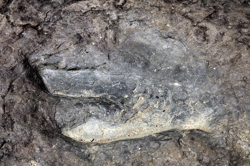
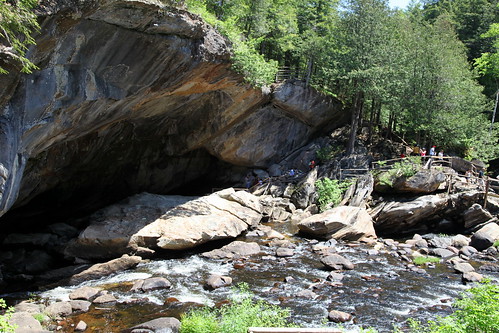 |
| The natural bridge - note size of humans for scale! |
And so in the latest of our masochistic peak-bagging excursions, Matt and I decided it was time to make the most of the extended Memorial Day weekend and pay a visit to the Adirondacks. I, of course, picked out the tallest of the mountains to climb, and it was decided that we would hike Mt Marcy, NY State's highest point at 5,344 ft. I toyed with ideas of extending the hike overnight, but with a lack of backcountry camping equipment and a fear of seemingly over-prevalent bears in the area, we opted to man up and take on our longest day hike to date as well - around 14.8 miles roundtrip on the Van Hoevenberg trail.
I booked a campsite for two nights at Meadowbrook Campground, a half-hour drive away from the trailhead at the Adirondack Loj, since it fit the budget much better than the exorbitantly-priced (in my opinion) Loj. We hit the road on Saturday morning with hopes that the forecast for chance thunderstorms would prove to be a lie, and headed out West to see what the weekend would bring.
 |
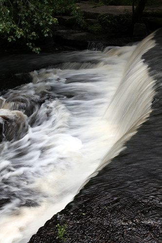
| Waterfall in Noisy Cave |
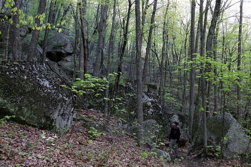
We made a stop en route at the
Natural Stone Bridge and Caves to have a little picnic lunch and to check out some geology. We paid the slightly steep admission (I'd recommend printing out the coupon on their site to save a buck!) and joined the holidaying throngs on our "self-guided exploration tour" through the park, which wound its way through and around various formations of interest, the most prominent being the Natural Bridge, which touts itself as the largest marble cave entrance in the East.
We got to check out a few caves, although we didn't have time to embark on the more in-depth adventure tour which gets a little more wet and wild. Noisy Cave was a winner in our books - an underground cascade of foaming white water, roaring over glossy smooth black boulders. Unfortunately, the crowds were getting to us and we made our way fairly quickly through the park, taking in the various sights such as Lost Pool Cave, Garnet Cave, The Potholes, The Oyster Shell and a not-so-tranquil Tranquility Point as efficiently as we could without becoming too entrenched in human traffic jams.
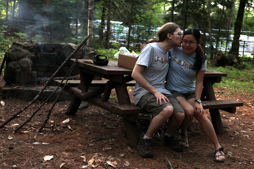 |
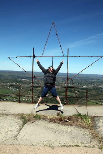
| Us being cute in matching "Doctor Hoo" outfits |
A scenic drive through the rolling green mountains later, we found ourselves at the campsite just outside of Lake Placid - home to the Olympic training center (I got my first glimpse of ski jumps, and found them to be quite terrifying). Apparently our campsite was located right next to a bar/barbecue joint, and we braced ourselves for a night of mediocre music to come, although we figured it was a decent trade-off for a decided lack of marauding bears. The evening went by quickly - tent up, fire started, hot dogs eaten, and an early bedtime with the drifting melody of "These Boots Were Made For Walking" to lull us gently to sleep.
We were up well before 5 am, with the intention of hitting the trail before 6. Packs ready and boots laced up tight, we jumped into the car, turned the key in the ignition, and...had our hearts skip a beat as the engine sputtered and failed to start. Apparently, our battery was dead. We surveyed the campground with sinking hearts as the utter still of pre-dawn lay fixedly over every soundly-sleeping camper, as we were apparently the only ones trying to get any sort of early start that morning.
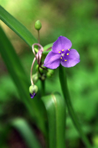
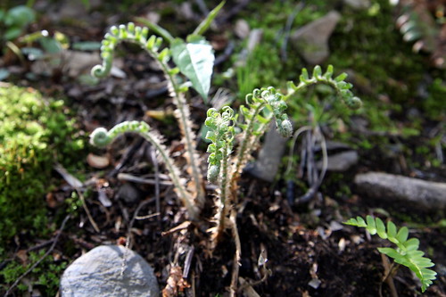
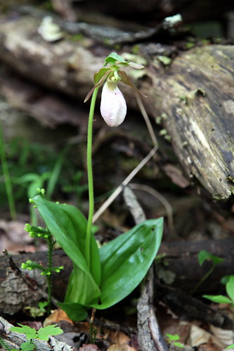 |
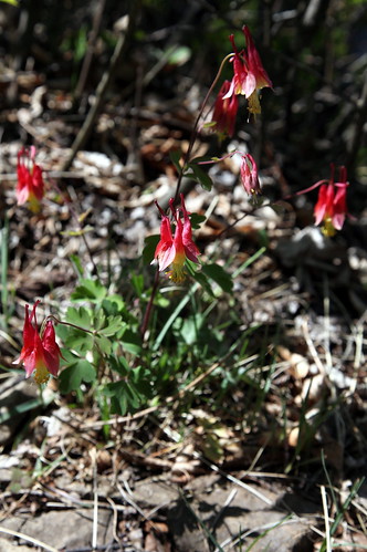
| Lady's Slipper Orchid |
Undeterred, I made a round of the grounds on foot to search for a waking soul, but my efforts were in vain. No one else was up and about. I steeled myself to attempt flagging down one of the occasional vehicles that were driving past on the main road, and began trudging over to the roadside when a flicker of movement caught my eye - was it a human? Yes, someone was heading over to the bathrooms! I ran over and waited outside for them to reemerge before pouncing on my prey - a still sleepy Asian man who thankfully had a vehicle and was enough of a good Samaritan to come over and jumpstart us.
Nothing comes easy though, and we got slightly (embarrassingly) lost trying to navigate back to our site (it's strange how different things seem on foot when you're used to seeing them from a car), but we eventually made it, managed to maneuver the cars within cable-length distance of each other despite some inconveniently-placed trees, and the jumpstart actually worked. Thankful that we had woken up ahead of schedule and were still in good time, we made the drive over to the Adirondack Loj, paid up the day parking fee and began our expedition.
 |
| View at Marcy Dam |
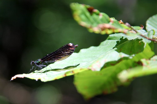
We signed the register and hit the trail - the first 2 miles in to Marcy Dam were fairly flat and uneventful, and we made fairly good time in around 45 minutes. We were excited to see some Lady's Slipper Orchids along the way, as we had somehow assumed that orchids only grew in the tropics (apparently the Lady's Slipper is Prince Edward Island's provincial flower...I would have never thought that orchids would be found in Canada, but these can apparently be found pretty much up to the Arctic Circle!).
Marcy Dam was a good spot for a quick sit and relax, with the mirror-calm waters reflecting the imposing mountains surrounding the lake - Mount Colden, Avalanche, Wright Peak, and Algonquin, I believe. The view was pretty, but it was still too close to ground level - we didn't want to dawdle too much as we knew the path was only uphill from there on, and we resumed our onwards journey after a brief rest.
 |
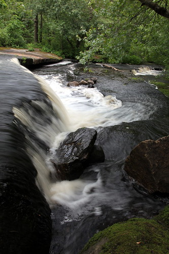
| Indian Falls |
The path began climbing and we hopscotched over Phelps Brook, onwards and upwards...and upwards...and upwards. We passed the turnoff for Phelps Mountain, but our trail kept going, sometimes through unavoidable muddy stretches, sometimes over boulders and rocky terrain. We kept leap-frogging another group of hikers (one in blue jeans and basketball shoes on his first mountain climb, who seemed none-too-excited about the length and steepness of the trail we were on). This section of trail seemed to last forever, but just as I was beginning to question my sanity and the scale of my trail map, we stumbled upon the sign for the little detour to Indian Falls.
It was a heart-lifting moment to emerge onto the rocky outcrop from which the falls cascaded, and to see the peaks of the Adirondacks stretching out before us. We took a moment to enjoy the panoramic view and managed to get our shoes wet while splashing over the fall's headwaters, but we returned to the trail proper with renewed vigor.
 |
| Taking a break |
The trail kept climbing and so did we - although we now managed to catch occasional glimpses of the summit, which still looked both discouragingly steep and distant. We finally reached a sign that claimed that only 1.2 miles were left to go - although we later learned that "Adirondack miles" can often be deceiving, and I will vouch that these 1.2 miles definitely felt closer to 3! A good section of the last push happened to involve a lot of scrambling up some extremely steep open rock faces, which led to some choice swear words and a lot of panting in between. We took a lot of breathers in between rather short sections of scrambling, but we plodded doggedly from one yellow blaze to the next, and the summit slowly grew closer and closer until...we were there!
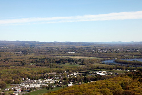
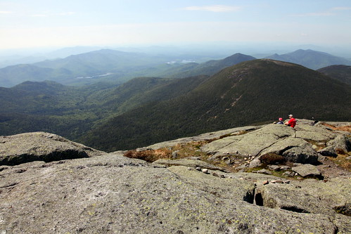 |
| View from the top |
Mother Nature had been kind enough to ward off all potentiality of thunderstorms, and had graced us instead with gorgeous blue skies and sunshine. The Summit Steward at the top (yes, it is actually someone's job to hike up this mountain every day to educate the hiking masses about the fragile arctic-alpine zone - a commute I will never be bad-ass enough to make) was kind enough to snap our photo and point out some of the other peaks in the Adirondack Range, the Green Mountains in Vermont, and all the way to Canada! To our relief, Blue Jeans made it all the way up as well, and proceeded to collapse gratefully on a welcoming rock with exclaimed hopes that the way down wouldn't kill him - we didn't see the group again on the way down, but I hope he made it safely and without an excessive amount of pain!
We admired the rolling, hazy greenery that seemed to stretch into forever, and picked out our next Adirondack conquest (Algonquin, the only other over-5000-footer in the range) as we munched on victory Snickers bars and basked in the sunshine, willfully ignoring the fact that we still had over 7 miles to go on our way back down. Sadly, our mountain high couldn't last for ever and after sufficient snacking, we picked ourselves up and got ready to return from whence we came. Off we went, but not before checking out the memorial plaque that proclaimed that we were standing on "Tahawus - Cloud-Splitter", which we felt was definitely a more fitting name than Marcy, considering that the guy only commissioned the expedition and didn't even climb it himself...
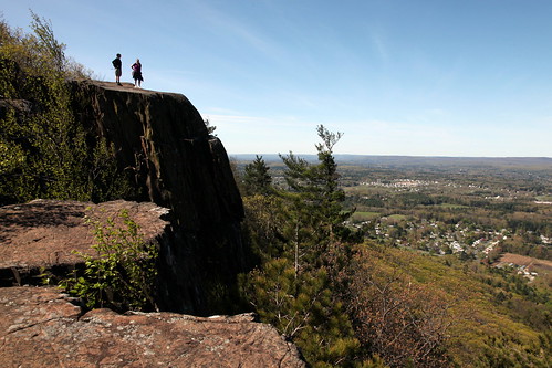
 |
| We made it up! |
Anyway, back down the steep slopes we went, crab-walking gingerly down the slabs of stone and wondering how we had ever made it up in the first place. The journey back down went much quicker, although the sun was well and thoroughly out and merrily beating down upon us, which made us lag a little. The section between Indian Falls and the Phelps Mountain turnoff definitely dragged on forever, but eventually we made it back to Marcy Dam for another Snickers break and to rest protesting knees and aching feet for a few short minutes.
With the home stretch in sight, we powered through the last 2 (thankfully relatively flat) miles back to the trailhead, although they were 2 miles that I could have definitely done without. We made it back to our car at 2.45 pm, having started the trail at 6 am, jelly-legged but content with our 8 hour 45 minute hike time and another gorgeous high point summited.
More photos from the trip can be found in my Adirondack album on my Flickr page!


