Showing posts with label Massachusetts. Show all posts

Sunday, May 12, 2013

Bear Mt & Mt.Frissell, CT

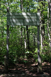
Riga Junction
It has been an embarrassingly long time since I've posted, and I will be trying to get some long-overdue trip reports written up...here's one from last summer!

Our continued pursuit of state high points led us next to...Connecticut! CT is one of only two states (I believe Nevada is the other one) to have a high point located not at the geographical summit of a mountain, but on a slope of a mountain that summits in an adjacent state. The south slope of Mt. Frissell (which tops out in Massachusetts) claims the state's high point at 2,380 ft, and is marked rather unassumingly by a teensy little green-painted brass pole just a few inches high, which has been dubbed by the affectionate moniker of CT's "Green Stake". 
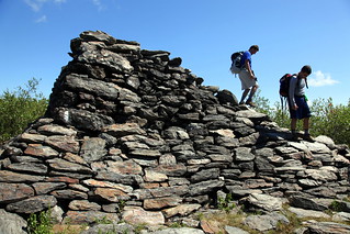
Pyramid at summit of Bear Mountain
While planning our hike, I figured we would throw in CT's highest summit for good measure - the more popular Bear Mountain (2,316 ft). I planned our hike based on this trail description, which claimed that it would take us 6 hours and approximately 9.6 miles (we later discovered that 9.6 miles may have been a little misleading!) to bag both peaks.

A sunny July weekend found us hiking up our packs at the Undermountain Trailhead off Rt.41 in Salisbury, CT. The initial climb from the Undermountain lot to Riga Junction where we turned north on the Appalachian Trail was a breeze, and about an hour after we hit the trail, we found ourselves clambering up the pyramid of boulders that marked the summit of Bear Mountain. The view from the top revealed rolling green hills dotted with lakes - a pleasant sight to enjoy as we munched on home-baked banana bread to fortify ourselves for the next leg of the hike. We scoffed a little as we read the informative plaque that marked the "highest ground in Connecticut" - we knew better, of course!  

View from Bear Mountain's summit
I was a little uncertain about how the trails connected over to Mt. Frissell past this point, but we chatted with a few fellow hikers who had done the loop before and they offered to show us the turn-off at the base of Bear's north side. However, they seemed surprised when I mentioned that it was supposed to be 9.6 miles for the round trip, as they seemed to remember it being closer to 12-13 miles - a warning I should have taken more seriously, I suppose!

We clambered down Bear's significantly steeper north slope together (doing fairly well at making conversation simultaneously, I must say - they were excited to meet someone from Malaysia as they had either spent significant time there or had friends from there, or something of the sort - I can't remember!), and once the trail had leveled off a bit we parted ways (with a selamat jalan!) as our unblazed/unsigned (but wide) trail came up on the left.    
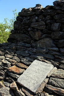
Misleading plaque on Bear Mt
We followed the flat trail over a mossy and slightly swampy area, past the AMC northwest cabin and on to its intersection with Mt.Washington road. It took us a minute or two to pick up the trail across the road since there was no signage to be seen, but we started following some red blazes and soon came across another hiker coming the other way who confirmed that we were heading up the right trail. 

I suppose I must say that we were guilty of assuming that CT wouldn't stack up to the 4000-footers of NH and NY, and that our (supposedly) 10-mile day would be a breeze (especially after how easy Bear had been), but as we hit our first scramble, I finally figured out that CT did have some good uphill inclines to offer. We huffed and puffed our way up and over the summit of Round Mountain (it had seemed like such a minor detail in my trail description!), swore a little at how we were nowhere near to being done, and huffed and puffed our way up another very respectably steep portion of trail to the top of Frissell. I believe there is supposed to be a log somewhere at the summit, but we didn't find it or sign it. 
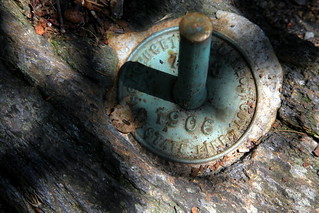
The Green Stake in all its glory
We kept going along on the trail in search of the Green Stake, and not too long after we started going downhill we came across an older couple having a snack and enjoying the view. We stopped to ask them about the stake and would you know, they were sitting right next to it! We would probably have walked right by it if they hadn't been there - yes, it's actually that tiny (that's what she said?).
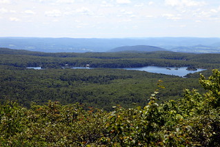
View from the high point
High point photos and a breather later, we decided to keep trucking onwards to see if we could find the tri-state marker where CT, NY and MA all come together. We weren't sure how far we needed to go, but after clambering down a steep section (that I lamented we would have to climb back up later), we came across the stone pillar (I'm estimating about 1/3 miles from the high point...you can't miss it). As many have pointed out, NY and MA have their state names well-engraved into the pillar, while CT has needed all the help that it could get from hikers with rudimentary etching skills and a sharp stick or stone.
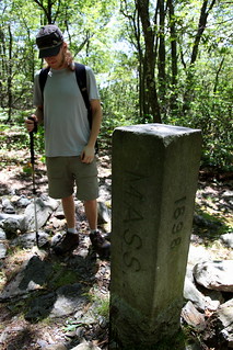
Tri State Marker
We took more obligatory photos (while I made nerdy references to existing in 3 states simultaneously, not that I know much about triple points or physics in general) and made the walk around the marker to make sure we had actually set foot in all 3 states before turning around to embark on our return journey. At this point the summer heat was getting to me, and I was definitely somewhat exhausted and headachey on the trek back to the car - also, we were definitely agreeing with the 13-mile estimate at this point and had to embrace the fact that we were getting a little bit of a longer workout than anticipated.

Snake slough!
We did come across a cool snake slough (rare rattlesnakes are supposed to inhabit this area, although we didn't see any) on our way back up and across Frissell and Round Mountain (this stretch seemed to go on forever), and once we had crossed the dirt road and made it back to where we had turned off after Bear Mt, we kept left to loop around on Paradise Lane Trail so as not to summit Bear again. At this point,  the trail back was pretty easy and we did make it back to our car about 6 hours and change after we left. 

All in all, definitely a good day's hike that left me with legs more achy than I had anticipated...but another high point bagged is always a great feeling! I didn't take too many photos on this hike but there are a few more over on my flickr site.

Tuesday, December 4, 2012

Wachusett Hike - An "Eft-ing" Good Time!

Windmill just off Harrington
Living in Rhode Island means that the immediate vicinity tends to be rather flat. For someone who likes hauling herself up things that reach a little higher, this tends to mean a drive of at least 2.5 hours each way - not always the most appealing thing to do for a day hike. Since driving is one of the few things in life that makes me nervous, the boyfriend always does the brunt of the driving. It makes me ever-so-slightly guilty, but never quite feel guilty enough to volunteer to drive, but I figured I could at least find something a little nearer to us - and thus the hunt for a littler mountain closer to home began.

I was hoping to find something that would still provide a decent hike sans the long drive, and finally settled on Mt. Wachusett in MA - high point of Worcester county and the 92-mile long Midstate Trail, topping out at 2006 feet. While the peak seemed to be more famous for its skiing than anything else, I figured it would still provide enough mileage on the trails that circle the park to make up for lack of elevation gain. I styled a 7.5 mile fancy twisted figure-eight loop based on this trail description, which sounded like a good way to cover most of the trails in the reservation and give us a good feeling for the area.

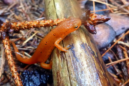
Red eft
A mid-August morning brought grey skies and a 30% chance of "light rain" on the forecast, which we figured was worth the gamble - plus, the trail description had mentioned a sighting of a red eft in rainy conditions, and newts seemed like a worthwhile cause to brave the potential wet weather, especially since none of us had seen them before. The weather seemed promising as we drove northwards, with only a few sprinkles gracing the journey, but by the time we pulled up at the trailhead the clouds had swept in and rain had started coming down fairly steadily. Still in good spirits and figuring that I had to field test my Outdoor Research Reflexa jacket sooner or later, we hit Harrington trail and began our ascent.

Our first stop was a little side trail to the windmill farm, where we peered through rain-clogged eyelashes at the white towers. Our observation of the windmills was sadly short-lived, as we quickly realized that the mosquitoes were not being dampened by the weather whatsoever, and we bid a hasty retreat while slapping, scratching and belatedly trying to spray ourselves down with repellent - a somewhat pathetic endeavor, as the rain had gained even more enthusiasm and was washing away the spray as quickly as we could attempt to get it on.

Waterfall of a trail
We headed back on Harrington and observed that the "30% chance of light rain" was now decidedly in the "100% steady and heavy" category, and the trail was starting to resemble more of a waterfall than a trail. Onwards we trudged through the muddy rushing water, feet sloshing around in waterproof boots that were now doing more to keep water in rather than keep them out, and myself rapidly coming to the unfortunate and uncomfortable realization that a mosquito had somehow managed to give me a loving bite right on my (now fat and swollen) lip. The rain, instead of dissuading the insects as we had hoped, only seemed to give them reason to become trapped in our hoods - I suppose the appeal of a dry warm nook and the proximity of tasty human blood made for an irresistible combination - and to our dismay, the high-pitched whining of wings and a frenzied shaking of our heads soon became an annoying constant as we ventured on uphill.

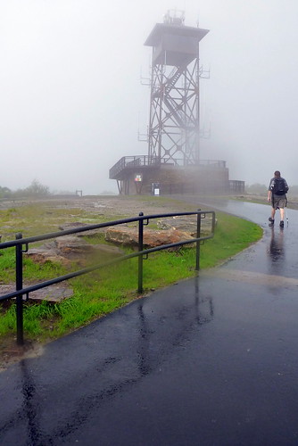
Fire tower at summit
As we were wondering why we thought it would be a good idea to squelch miserably through the woods rather than stay cozy and dry inside, we spotted a bright orange streak that stood out in stark contrast to the soggy moss it was framed against. Closer inspection revealed our first red eft of the day! We oohed and ahhed at the little lizard and admired his neon black-ringed spots, delighted at his awkward waddling gait, and pondered his zen-like indifference towards both us and the weather. It took us a little while to tear ourselves away from our tiny orange friend, but when we started moving again, we started seeing more orange lizards literally everywhere - smack in the middle of the trail, sitting on rocks or hanging out on tree trunks. To our delight, the woods were replete with efts that had emerged to enjoy the downpour that Mother Nature was unleashing upon us. We resorted to walking gingerly at this point to avoid squishing any of the little critters, and even moved some that were sitting in the middle of trail so they wouldn't be stepped on by any other crazy hikers who might have been out that day.

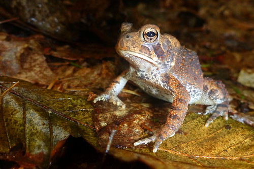
A regal toad on the trail
Tallying efts proved to be the only distraction from the incessant cold rain and the horrible feeling of squishy sodden socks as we squelched our way to the top. We finally reached the summit, a drenched and disheveled trio (2 of our party even managed to aid and abet the rain by dumping accumulated rainwater from their hoods down their backs), and took a minute to huddle beneath a little overhang at the fire tower and attempted to wring our muddy socks out, although to not much avail. We were halfway through our planned loop at this point, but when I broached the suggestion of continuing our hike down to Balance Rock on the other side of the mountain, I was greeted with a hearty nay - and I must admit I was pretty relieved that my proposal was shut down.


Another eft hanging out
It seemed as if the desire for dry feet had won out over any further inklings for adventure that day. With not much of a view to enjoy at the summit beyond snapping a quick soggy self-portrait, there seemed to be no reason to linger, and so we headed back down Mountain House Trail - Bicentennial Trail - Echo Lake Trail, spotting some more amphibious friends on the way - yet more efts, a toad and some frogs, who were obviously faring better in the rain than we were. We made it back to the car around 3 hours after we embarked (thanks to a lot of dilly-dallying and looking for efts), with a grand tally of a whopping 44 live efts spotted that day and many scooped up and off the road to safety, although sadly we did also see many a mangled remain of an unfortunate lizard who had met one car too many.

Echo Lake Reflection
We clambered into the shelter of the car, although of course the rain had died down by this point. Still, it was a relief to strip off wet socks and free wrinkled toes from their watery confines, and we enviously watched another hiking couple parked just down the road from us who had had the foresight to bring extra clothing to change into post-hike. I peeled off my new rain jacket to discover that it had soaked through pretty much everywhere - it was decidedly a trip back to REI for this jacket, which was kind of disappointing (it was such a pretty berry color!), because it had seemed to fit well and had plenty of nifty features...but what use is the fanciest rain jacket if it doesn't keep you dry?

We were more than ready for warm beverages and a hot shower at this point, and were excited to get on our way home, although I had a feeling we would return to Wachusett at some point - if for nothing else, to see what kind of view was to actually be had from the top.

Monday, April 30, 2012

Dinosaur Footprints, MA

Welcome to Dinosaur Footprints
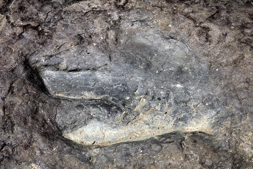
190 million years ago, dinosaurs roamed our backyards. Despite their apparent commonness in this region of the world, I had never seen any evidence of dinosaurs outside of reconstructed skeletons and fossilized eggs kept safe beneath the arching hallways of various museums. When I read that a little site (aptly) called "Dinosaur Footprints" contained hundreds of fossilized dino footprints and resided just off Rt. 5, I figured it would be a fun little stop on our way back from hiking Mt. Tom (see previous post), since we would be driving past it anyway.

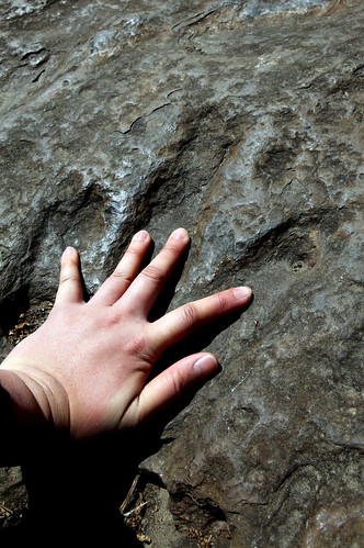
Touching the past
A little pull-off on the side of the road accommodated a few cars, and a sign welcomed us to the site and warned of the 10 ft elevation change which we figured we could handle. A short pathway sloped down to the riverbank next to the sedate Connecticut River, and we quickly came upon the large flat slabs of sandstone that contained the footprints. They were discovered in the 1920s during the construction of Rt 5, which was probably a nice surprise and a good distraction from highway-building for the workmen.

We quickly found the largest 3-toed impressions, which were created by two-legged carnivorous dinosaurs called Eubrontes giganteus, which could reach 15 feet in height and had a 6-foot stride, and were also possible ancestors of Tyrannosaurus rex! We had fun comparing our respective hand and foot spans to the impressions, but unfortunately did not do too well at identifying any of the other purported fish, plants and stromatolites that were supposedly also present in fossilized form. 

I believe that these were some of the earliest dinosaur footprints ever to be discovered, and were also responsible for birthing the theory that dinosaurs were not all solitary but often traveled in groups, as 28 distinct trackways were identified by Professor John Ostom of Yale in the 1970s.

Bigfoot
It was a pleasant little stop and nice to see dinosaur evidence in its natural habitat. It was fairly quiet - we did see just one other dad-and-son combo checking out the footprints, and it was nice to (over)hear from the exclamations that kids today are as excited about dinosaurs as always!

This site does not allow plaster casts of the footprints, but I hear there is another park in CT that does, so we may unearth our inner kids someday to cast some tracks and paint them!

Sunday, April 29, 2012

Hiking Mt Tom, MA

0.5 miles in, 2 miles to the top!
Itchy feet were calling to climb a mountain, and I picked Mt. Tom (in Massachusetts, not to be confused with the apparently identically-named other 42 mountains in the USA) as our first peak of the spring. At an easy 1202 feet and just under 5 miles for the hike, I figured it would be a mild warm-up for the rest of the year - especially since we were bringing along a friend who was relatively new to the world of the trail and had never really climbed a mountain before (and I didn't want to scare her off!).

Mt. Tom is part of the 110-mile Metacomet-Monadnock trail that stretches from Connecticut to New Hampshire, and is a basalt/traprock mountain unique for its cliff formations. It's also a hotspot for raptor migration (although that happens in the fall, so perhaps we will be back for some birdwatching!). The promise of dramatic cliffs as well as the chance to come eye-to-eye with some raptors sounded like an excellent use of a sunny weekend, and so we hit the road at 8 am on a Saturday afternoon to drive the 1.5 hours to Holyoke MA.

The gentle start of the white-blazed trail
We initially drove right past the turnoff to Reservation Road on Rt 5 (the sign to the park is only really visible if you come from the north), but pulled a turnaround a little ways up the road and drove in to the trailhead parking near the visitor center in the center of the park. The center was closed, but we took a brief glance at the information board outside that talked about the history of the area including the summit house (Mt Tom Hotel) that burned not once, but twice, and a "mysterious 50-degree breeze" that emanated at all times from a cleft in the rocks and was used for refrigeration purposes in times of yore.

Curly ferns
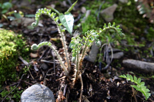
All breezes were in the 50-degree range this morning and not particularly mysterious but rather, fairly brisk. We started our way southward along the white-blazed trail after a quick bathroom trip in the woods. The trail meandered on fairly gently before hitting a short, steep incline to the top of the ridge. We were probably making too much noise to have any chance of seeing any wildlife, but we did come across some ferns that we hoped (in vain) would turn out to be fiddleheads. We noted the change of the rock underfoot as we neared the top - the way the basalt broke off in angular, clean cuts looked almost crystalline and was pretty cool to look at.
The Pioneer Valley

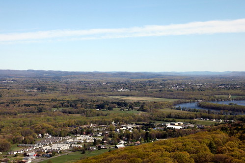
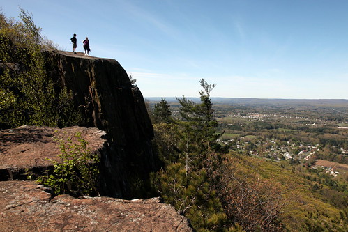
Breaking out on to the ridge immediately brought great views of the Pioneer Valley sprawled out before us in the sunshine, with the Connecticut River lazily meandering its way through the spring green, and the Berkshires rolling along the horizon. It was a nice change to have solid views for most of the way along a hike, as the path clambered up and down over rocky formations and followed the cliff side, sometimes hugging the edge closely enough to perhaps cause trouble for one afraid of heights! I know we at least were grateful that the wind was blowing on to the mountain and not the other way.
Chilling on a cliff
We were fortunate enough to spot two turkey vultures that morning - the first one flew by a mere 20 or so feet from us, with a crow in hot pursuit. It was pretty funny to see the large vulture being chased by a significantly smaller bird, but it was exciting to see one so close up and actually be able to see its bald red head and wobbly wattles. We did spot a few other raptors, presumably hawks, and can only imagine the area full of magnificent birds during peak migration season! Unfortunately, the birds went by too swiftly and unexpectedly to be good photo subjects. We also came across a cocoon/nest of tent caterpillars chomping their merry way through the early spring buds, and those proved to be more photo-friendly, but that was it for our interesting animal sightings of the day.
Tent Caterpillars

Excited to be at the top!
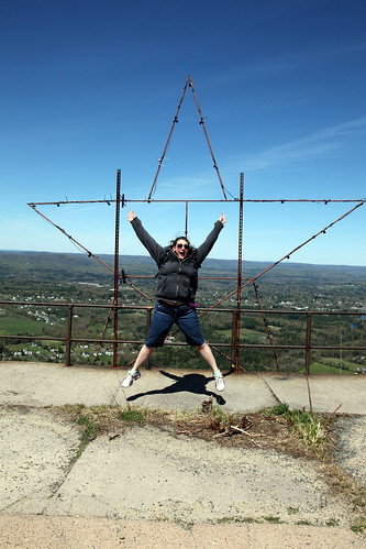
Despite the popularity of the trail, at some points it seemed as if it could have been better blazed. We ended up on a slight detour at one point when we accidentally followed a pseudo-path until it petered out, and spent a few other moments having to pause and search out the next blaze to guide us on. We eventually made our way past the first few telecommunication poles and a windmill, and finally made it all the way to the summit, which, unfortunately, was full of more communication towers (some even warning of unsafe radiation limits!). The summit was also home to a star-shaped frame with lights, and a flagpole, and unfortunately, litter here and there (we've started trying to pick up recyclable litter when we're out and about, but it's always frustrating to see). Mt Tom is apparently a broadcasting hotspot for a few TV and radio stations, and we sat on the steps to one of the buildings and snacked eagerly on trail mix, Snickers and bananas before turning around to head back the way we came.

Water by the trail
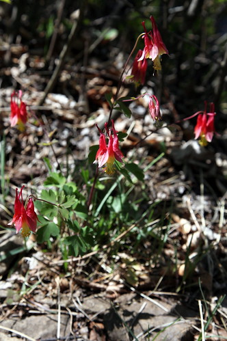
Spring blooms
The way back down passed much more quickly than the way up since we stopped less to ogle the views, and we  found ourselves back at the car park surprisingly quickly. We had spent about 3 hours in total for the round trip hike at a causal pace, with a detour for good measure, and a fair number of view-admiring stops. I'd say Mt. Tom was overall a pleasant and not-too-strenuous trip with a few fun rock scramble bits through cool geological features and a great view to accompany - all-in-all, a good pick for an introductory hike - a thought reinforced by the fact that our friend wasn't scared off climbing future mountains - in fact, she loved it! It was a great way to kick off our climbing season and we're definitely excited for some bigger peaks to come...


A couple more photos from this trip are up on my Flickr page if you'd care to check them out!

Sunday, April 8, 2012

Ponkapoag Pond, MA


The Blue Hills span an area of 7000 acres just a tad south of Boston - a green little escape that we'd overlooked thus far in our nature pursuits in favor of hikes further afoot. However, this overcast Easter Sunday seemed like a good time to head out and see what treasures lay in our own backyard, and so the bf and I headed out to stroll the Ponkapoag Pond loop - around 4 miles of mostly flat trail that surrounds Ponkapoag Pond and its adjoining patch of white cedar bog.

45 minutes and a Honey Dew stop after leaving RI found us pulling into the "parking lot" off of Route 93, which was in reality a little cul-de-sac with about room for 8 vehicles - I'm not sure how busy the area gets, but you might want to get there early to be sure of snagging a spot! We polished off some brownies for sustenance before hitting the trail, opting to embark in an anti-clockwise direction following the green dot trail blazes around the pond.

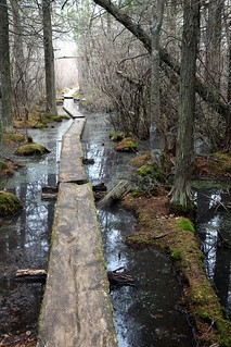
A few minutes in, we passed a YMCA center and reached the turnoff for the boardwalk that led out into the middle of Ponkapoag Bog, a white cedar bog that offered what we thought was a tantalizing opportunity to see some carnivorous plants and hopefully a salamander or two. The boardwalk proved to be exactly that - a series of single boards laid out across the bog, some more deceptively stable and less afloat than others. Definitely a tad less structured than the boardwalks we'd been accustomed to elsewhere! We picked our way out into the bog trying not to get our toes too wet, as the boards would often sneakily dip when you stepped on them. Luckily the weather had been pretty dry over the past few days and we made it out the whole way to the end of the walk with mostly dry feet. At this point the walk simply ended at the edge of the pond proper, and it was a choice between donning swimming gear or turning back around - we opted for the latter especially since 50 degree weather was still a little too chilly for a dip!

The walk was pleasant, mysterious and mossy over dark tannin-stained water with the cedars arching still mostly-naked branches overhead. We thought we picked out some pitcher plants lying low on the ground, but the furled purple-spotted vegetation turned out, on later investigation, to be swamp or skunk cabbage (Symplocarpus foetidus) instead. Unfortunately, no amphibians, reptiles or fish came out to play and the only animals that we heard or saw were birds.

The remainder of the circuit around the pond was pleasant if unremarkable - the spot by the dam with open water was pretty, and offered a sighting of a lone flying goose and some ducks a-bobbing for lunch. It was fairly quiet on the path although we did come across several other people, many with dogs in tow and some on horses, and at one point the trail passed through a golf course where some folks were out and about getting their game on.

It probably took us under two hours to walk the boardwalk and the circuit at a leisurely pace - all in all a pleasant little excursion if you're looking to just get out of the city for an hour or two and take a little stroll. Checking out the bog was definitely a neat experience and a little change of scenery from typical New England walks. We'll definitely be back in the Blue Hills in the near future to check out some of the other hikes!